Advertisement


When should a housing society in Mumbai start considering re...
From GST on JDAs to SEBI’s REIT reclassification and the S...
Stay ahead in the world of real estate with our daily podcas...
Stay ahead in the world of real estate with our daily podcas...
The Saharsa district administration has taken steps to modernize its operations by digitizing its collectorate and subdivisions through e-offices. As part of this effort, they have recently introduced a new mobile application that allows for land measurement, which can be used for various purposes such as buying, selling, or identifying encroached land. This initiative aims to address the issue of land disputes, which often result in conflicts and violence.
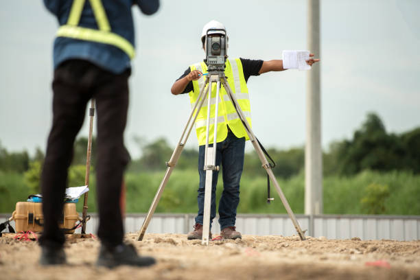
The Saharsa district administration has taken steps to modernize its operations by digitizing its collectorate and subdivisions through e-offices. As part of this effort, they have recently introduced a new mobile application that allows for land measurement, which can be used for various purposes such as buying, selling, or identifying encroached land.
Advertisement


This initiative aims to address the issue of land disputes, which often result in conflicts and violence. Additionally, it aims to create a centralized system for land measurement, making it easier for government officials to manage and access land data. The pilot launch of the mobile application in Kehra circle under subdivision has received positive feedback, and the administration is now planning to expand its usage further.
The recently launched mobile application called “Saharsa Bhu Mapi” is available for download on Google Playstore and can be used on any Android device. Through this app, users can submit online applications for land measurement, which will be forwarded to the circle officer for further processing.
Saharsa district witnesses a significant number of land dispute complaints, with approximately 200 cases being reported during the weekly DM’s janata darbar (public meeting with the District Magistrate). In addition, there are hundreds of other complaints reported from the gram kachhari (village courts) of 135 panchayats in the two subdivisions. Alongside the land dispute issues, the district also experiences a high volume of new land registrations.
Bhu mapi can be installed on a mobile device, such as a smartphone or tablet, and is designed to help users measure and calculate land area, distance, and other relevant metrics. These apps typically utilize the device’s built-in GPS (Global Positioning System) capabilities and other sensors to provide accurate measurements and mapping functionalities.
Here are some key features commonly found in mobile land measurement apps:
Mobile land measurement apps can be useful for a variety of purposes, such as real estate professionals, land surveyors, farmers, landscape designers, and outdoor enthusiasts who need to measure and map land areas for planning, estimating, or recreational purposes. It’s important to note that the accuracy of measurements may vary depending on the device’s GPS accuracy, the app’s algorithms, and other factors, so it’s always recommended to cross-check measurements with professional surveying methods when precision is critical.

5th Jun, 2025

25th May, 2023

11th May, 2023

27th Apr, 2023
Advertisement


 Facebook
 Whatsapp